Sidebar
Transportation
If you ride MARTA buses regularly, I'm slowly trying to get a UX put together that's usable at [https://martalith.fly.dev](https://martalith.fly.dev). Things like: - "I get on the same buses every day (at 2-3 stops) and just want to see my bus situation clearly/quickly" - "I transfer at X station regularly and want to know the status of Y/Z routes for that station" I've tried to build this in the past, and the bus data either confused me or didn't seem usable. But MARTA recently added realtime bus positions + trip update endpoints, and early tests are looking more positive! When I can find an excuse to ride buses, I'm testing things out, but it's slow-going. I try to remember to put updates here when things change https://fosstodon.org/@jakswa
Hey Neighbors (all over the metro). The Atlanta Regional Commission is working on an update of the Metropolitan Transportation Plan. They are currently in the public input phase. The survey takes about 15 minutes and asks about all sorts of priorities for the future of transportation in the Atlanta Region. [Direct Survey Link](https://www.menti.com/al9r8jj7zxwt/0)
 smyrnacitizen.home.blog
 www.ajc.com
 www.ajc.com
cross-posted from: https://yall.theatl.social/post/1816 > Atlanta is set to receive $25 million from the federal government to ramp up construction of Beltline trails on the northeast side of the city. > > The funds mark the largest federal grant in Beltline history and will go toward expanding more than 2 miles of trails between Armour/Ottley and Lindbergh areas. The additions will be the first time the Beltline will connect to a MARTA station — which will be at Lindbergh Center.
 www.threadatl.org
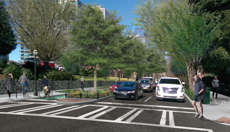
Councilmember Jason Dozier is sponsoring a set of zoning papers for the BeltLine overlay districts to disallow new car-oriented businesses like gas stations, drive thrus, and service stations, and to eliminate the mandated minimum number of parking spaces for new developments.

[OpenStreetMap ](https://welcome.openstreetmap.org/what-is-openstreetmap/) is a internet project that distributes free geographical data to the world. It relies on a community of volunteer editors to keep the information up to date. One benefit of OSM is that it allows groups of editors to decide what matters to them and add the features to the map, rather than hoping that some corporation decides that a feature is profitable enough. For instance, OSM shows the location of bike racks near the Decatur Library, and properly notes that the paths through Scott Park are foot-paths. 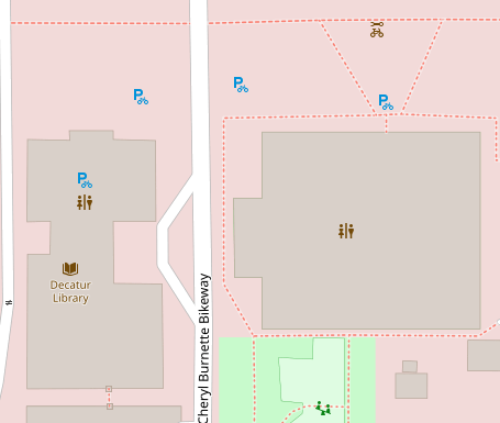 In contrast, the Google Maps "bicycle" layer does not include bike racks and highlights those footpaths as though they are appropriate for biking (despite being right next to a building with multiple doorways and sharp turns with no visibility) 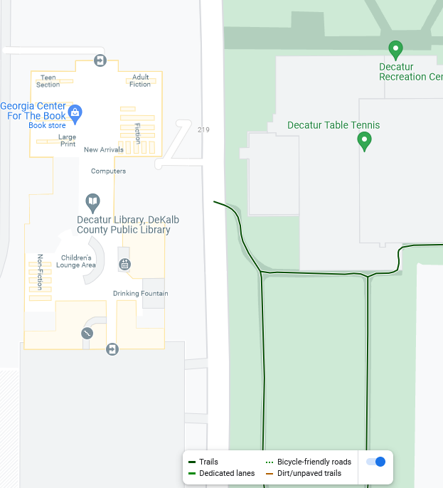 Still, OSM is not perfect -- I had no problem finding information that was right in Google Maps that was wrong in OSM (and vice versa). I figure that Google benefits either from web-scraping and more automation, or perhaps from more user feedback. OSM requires more effort, but this also means it gives us greater input over it's content (and has greater curation to avoid idiotic AI stuff). I signed up and made some edits myself -- OSM has a good editing interface and a good walkthrough tutorial. But I think the most important aspect is that OSM is free (as in speech), which means anybody can copy it and no single entity can just hide or discard all the data when it no longer fits in their business strategy. I found two cycling based projects based off of OSM: https://www.opencyclemap.org/ and https://www.cyclosm.org/. These are also shown in the "Layers" on OSM: 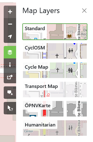 The maps displays are pretty complex, and I'm not sure if there's an easy app for planning your route using these data. I also found a project focused on wheelchair accessibility when I looked at the "history" view and saw that someone has been editing the decatur map from https://wheelmap.org/. So the end question is whether this map data can end up being helpful to both personal transportation and transportation advocacy in Atlanta. I'd love to hear any thoughts on this topic.